Difference between revisions of "Template:Area infobox"
Jump to navigation
Jump to search
m |
m |
||
| Line 2: | Line 2: | ||
--><!-- Count quests which have this location, defaults to zero otherwise -->{{#vardefine:quests|{{{quests|{{#ask: [[Has context::Location]][[Has availability::Current]][[Located in::{{PAGENAME}}]] | ?Has quests | link = none | format = sum | default = 0 }}}}}}}<div class="infobox-n area"> | --><!-- Count quests which have this location, defaults to zero otherwise -->{{#vardefine:quests|{{{quests|{{#ask: [[Has context::Location]][[Has availability::Current]][[Located in::{{PAGENAME}}]] | ?Has quests | link = none | format = sum | default = 0 }}}}}}}<div class="infobox-n area"> | ||
<p class="heading">[[Has canonical name::{{{name|{{#titleparts:{{PAGENAME}}}}}}}]]</p> | <p class="heading">[[Has canonical name::{{{name|{{#titleparts:{{PAGENAME}}}}}}}]]</p> | ||
<div class="statistics"><!-- | |||
-->{{#if: {{{weather|}}} |{{#arraymap:{{{weather}}}|,|@@@|{{#switch:{{lc:@@@}} | -->{{#if: {{{weather|}}} |{{#arraymap:{{{weather}}}|,|@@@|{{#switch:{{lc:@@@}} | ||
| blizzard = [[File:Blizzard (weather).png|18px|link=Blizzard (weather)]]{{#set:Has weather condition=Blizzard}} | | blizzard = [[File:Blizzard (weather).png|18px|link=Blizzard (weather)]]{{#set:Has weather condition=Blizzard}} | ||
Revision as of 13:30, 11 December 2017
Area infobox
- Type
- Unknown
Description
This infobox should be used for regions, zones, areas, landmarks, etc., i.e. all locations mentioned here. See also parameter type below.
{{Area infobox
| name =
| type =
| within =
| quests =
| aetherytes =
| weather =
| map =
| levels =
| connections =
| loading-screen =
| screenshot =
| sstext =
| id =
}}
Parameters
All parameters are optional.
- name
- Location name. Defaults to {{PAGENAME}}
- type
- The type of location. Accepts: region, city, dungeon, raid, instance, landmark.
- within
- The parent location of the location being described. Use plain text with no wiki-links. For zones, this should be a region; for areas, this should be a zone; for everything else, this will usually be an area. If within is an area or zone, the parent of within will be displayed underneath in small text.
- coordinates
- If specified, indicates position of a location within the world map.
- quests
- Number of quests
- aetherytes
- Aetherytes available in the current map. Accepts slash-separated list in the form
<aetheryte name>;<x,y,z coordinates>. - weather
- Weather conditions. Accepts comma-separated names: Common — blizzard, clear skies, clouds, dust storms, fair skies, fog, gales, gloom, heat waves, rain, sandstorms, showers, snow, thunder, thunderstorms, umbral static, umbral wind, wind. Special — auroras, core radiation, darkness, eruptions, gales (garuda), gloom (king moggle), heat wave, hot spells, hyperelectricity, irradiance, louring, oppression, rough seas, royal levin, shelf clouds, smoke, storm clouds, tension.
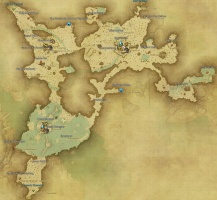
- map
- Map image (do not include the "File:" prefix). Defaults to '{{PAGENAME}} map.jpg'
- levels
- Depends on the type used, see as follows
- Zone: The level range for the zone. Separate minimum and maximum levels with a single hyphen "-", e.g.
60 - 70 - Area: The effective level of the area. For the case of dungeon areas where there are extra modes, separate values with commas.
- connections
- Other locations that this one has connections to. Usually only specified on zones. Separate multiple connections with <br> and add your own wiki-links. The cardinal direction is usually specified in brackets after the zone name; (N), (S), (E), (W), (NE), etc. In the case of a portal, add (portal) instead of direction.
- loading-screen
- Loading screen image (do not include the "File:" prefix). Defaults to '{{PAGENAME}} loading screen.jpg'
- screenshot
- Screenshot (do not include the "File:" prefix). Defaults to '{{PAGENAME}}.jpg'
- sstext
- Screenshot text
- locator
- Optional. Use to specify the SVG locator image if the page name doesn't match the filename. Defaults to '{{PAGENAME}} locator.svg'
- release
- The expansion required to access the content. Displays a notice of the release.
Examples
{{Area infobox
| name = South Shroud
| map = South Shroud map.jpg
| type = zone
| within = The Black Shroud
| quests = 58
| aetherytes = Quarrymill~25.0, 20.1; Camp Tranquil ~ 16.8, 28.6
| weather = gloom, fog, storm clouds, thunder, thunderstorms, tension
| levels = 20 - 35
| connections = [[Central Shroud]] (NW)<br>[[East Shroud]] (N)<br>[[Eastern Thanalan]] (SW)
}}
South Shroud
- Levels
- 20 – 35
- Type
- Zone
- Within
- The Black Shroud
- Connects to
- Central Shroud (NW)
East Shroud (N)
Eastern Thanalan (SW) - Aetherytes
- Quarrymill (X:25.0, Y:20.1)
Camp Tranquil (X:16.8, Y:28.6)
